
You can hike to the Hollywood Sign on three authorized routes in Griffith Park, and none of them costs a cent. The easiest are the Mt. Hollywood Trail and the Brush Canyon Trail, which run roughly 5 to 6 miles round trip and take about 2.5 to 3 hours. The hard one is the Cahuenga Peak Trail. Below you’ll find how each route compares, how to get to the trailhead without circling for parking, what the hike is really like, and when a tour or a helicopter flight is the smarter choice.
TL;DR
- Three authorized trails reach the sign area: Mt. Hollywood (easiest), Brush Canyon (most popular) and Cahuenga Peak (hard). Distances run about 3 to 6 miles depending on the route and who measures it.
- You hike to a viewpoint above or behind the sign. You cannot touch it: the sign is fenced, monitored by cameras and patrolled, and trespassing is enforced.
- Start early. The last stretch has little shade, and parking at the trailheads fills quickly. A ride-share saves a lot of stress.
- The sign is not lit at night, so skip evening hikes if the view is the point.
- Short on time, mobility or energy? A small-group tour or a helicopter flight shows you the sign without the climb.
Table of Contents
- Can you hike to the Hollywood Sign?
- The three trails compared
- How to get to the trailhead
- What the hike is really like
- Hike or tour: which is right for you?
- Our perspective
- See the sign without the climb
- A little history to carry up the hill
- FAQ
- Sources
Can you hike to the Hollywood Sign?
Yes. The Hollywood Sign Trust lists three authorized hiking trails: Mt. Hollywood, Brush Canyon and Cahuenga Peak. They are open to the public and free. Authorized trails follow Griffith Park hours, sunrise to sunset, every day of the year, according to the same page.
One expectation to reset before you lace up: the sign sits on a steep hillside of Mt. Lee, and the trails take you to viewpoints near it, not to its base. The sign is protected around the clock by a fence, security cameras and LAPD presence, and park rangers and police enforce the no-trespassing rule. Stay on marked trails, and don’t climb past the fencing for a photo.
The three trails compared
Published numbers differ from source to source because people start from different points and stop at different viewpoints. Treat the figures below as a planning range, not a promise.
| Trail | Difficulty (Hollywood Sign Trust) | Distance (Hollywood Sign Trust) | Est. time |
|---|---|---|---|
| Mt. Hollywood Trail | Easy | 5.3 miles | 2 h 28 min |
| Brush Canyon Trail | Easy | 6 miles | 2 h 45 min |
| Cahuenga Peak Trail | Hard | 3 miles | 1 h 45 min |
These come from the Hollywood Sign Trust’s trail page. Other guides rate the same hikes a bit tougher. One hiking guide calls the Brush Canyon route moderate, about 6 miles with roughly 1,100 feet of climbing, and plans 2.5 to 4 hours. Another measures 5.2 miles to the Tyrolean Tanks and 580 feet of elevation gain, with about 3 hours including sightseeing. My advice: plan for 3 hours, bring more water than you think you need, and you’ll be fine either way.
Brush Canyon Trail: the one most people do
Brush Canyon is widely described as the most popular route to the sign. It is well marked and well maintained, and the path is more like a paved dirt road with a steady, gentle incline than a technical trail. That makes it friendly for first-timers, kids who like walking, and anyone in moderate shape.
The trailhead is at 3200 Canyon Drive, where public parking is available but fills quickly.
Mt. Hollywood Trail: the gentler start from the Observatory side
This route begins in the Griffith Observatory area. The Hollywood Sign Trust rates it the easiest of the three, and its flexibility is a plus: you can turn around at any viewpoint and still have a good look at the sign. If you want to pair a city-view stop with your hike, our Griffith Observatory visit guide covers hours, parking and sunset timing.
Cahuenga Peak Trail: short, steep and demanding
The numbers look kind (3 miles), but the Trust rates it hard. Expect a steeper, more rugged climb. This one is for people who hike regularly, not for a casual morning between sightseeing stops.
How to get to the trailhead
Parking is the real obstacle, more than the trail itself. Hikers at Brush Canyon report that spots fill early, and that a ride-share to the trailhead is the stress-free option.
There is also a neighborhood factor. Residents of Hollywoodland and Beachwood Canyon have pushed to steer navigation apps away from their streets, so access can be tricky, and ride-shares to a legitimate trailhead such as Canyon Drive are a recommended workaround. Be quiet, don’t block driveways, and follow posted parking signs.
Practical directions for a Brush Canyon start:
- Set your ride-share or GPS destination to the Canyon Drive trailhead, 3200 Canyon Drive, not a residential street near the sign.
- Start up Brush Canyon Trail and keep climbing. One guide says to continue about a mile uphill before the route to the sign viewpoint becomes clear.
- At the junction roughly three quarters of the way up, the trail splits and a paved road continues higher up the mountain. That is the way toward the back of the sign.
- Turn around at the viewpoint, and give yourself the same energy for the walk down.
For the park itself, the City’s page describes ways to get to Griffith Park, which lies just west of the I-5 between Los Feliz Boulevard and the Ventura Freeway (SR 134).
What the hike is really like
Who it suits: anyone who can walk a few hours with some uphill. You’ll see thousands of people of all ages doing it on a weekend.
The catch is the exposure. The last mile to the summit behind the sign has very little shade, so a midday summer start can wear you down quickly. Early morning is best, and the cooler seasons are kinder. One local guide lists September through July as the best time of year, and names rattlesnakes, heat and smog among the hazards.
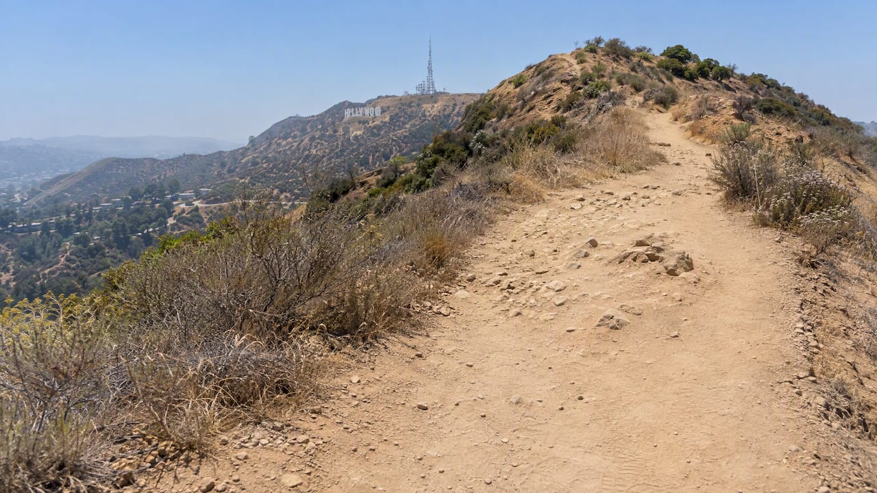
Time of day and the lighting myth
A lot of visitors plan a night hike to see the sign glowing. According to Griffith Observatory, the sign isn’t illuminated at night. Authorized trails also follow sunrise-to-sunset hours, so a nighttime trek has no payoff and may put you somewhere you aren’t allowed to be. Go early in the morning for the clearest light and the fewest people.
Safety checklist
Los Angeles park rangers treat Griffith Park as rugged, wildfire-prone urban wilderness, so go prepared. The Hollywood Sign Trust also warns of extreme fire danger on the trails, parts of which are still recovering from a 2007 wildfire.
- Carry at least a liter of water per person, more on warm days. There’s little shade and the climb is steady.
- Wear a hat, sunscreen and real shoes. Sandals and slides are the most common mistake on this trail.
- Stay on marked trails, and keep an eye out for rattlesnakes in warm weather.
- Download your map before you leave. Coverage can be spotty and navigation apps may route you oddly near the neighborhoods.
- Check for fire or closure notices before you go. In red-flag conditions, plans can change on short notice.
Hike or tour: which is right for you?
The hike is a good fit when you want exercise, you have 3 to 4 hours and your group is mobile. It is less of a fit when you have little time in Los Angeles, someone has limited mobility, the weather is hot, or you want stories rather than switchbacks.
| Hike | Small-group tour | Helicopter | |
|---|---|---|---|
| Cost | Free (plus parking or ride-share) | Priced per group or per person, see below | Priced per person |
| Time | About 3 hours or more | Set tour length | 10 minutes and up |
| Effort | Moderate, exposed climb | Minimal | None |
| Parking worry | Yes | None, pickup is arranged | None |
| Commentary | Whatever you read beforehand | Live local guide | Aerial view |
| Closest view | Viewpoint near or behind the sign | Photo stops from public viewpoints | From the air |
If you want to see more of how the options compare, our guides on how to see the Hollywood Sign the best way and where to take the best photos lay out the viewing spots in detail. For a few lesser-known vantage points that need no hiking at all, the Los Angeles Times has a list of 9 little-known ways to see the sign.
Our perspective
We drive visitors to the Hollywood Sign every week, and the same pattern repeats. People set out on the hike with enthusiasm, then lose an hour to parking, a chunk of their energy to the sun and, sometimes, their patience with the neighborhood streets. The ones who enjoy the hike most plan around that: early start, ride-share to the trailhead, plenty of water, a clear sense of where they’ll stop.
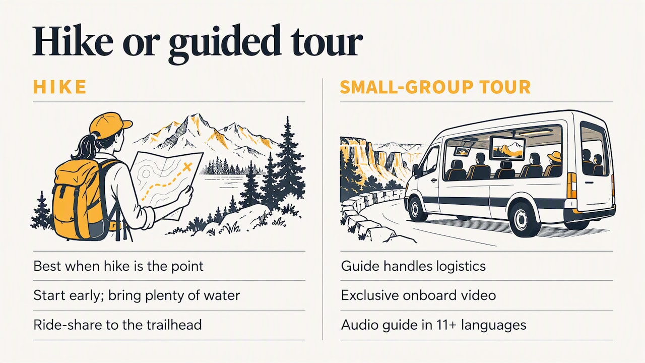
The hike is a good outing, and we’d never talk anyone out of it if they have the time and the legs. But many of our guests are in Los Angeles for a few days with a long list: the Walk of Fame, celebrity neighborhoods, the coast. For them, a morning spent on a dusty hillside is a trade-off worth thinking about. Our small-group format exists for that reason. A local guide handles the logistics, the screens onboard play exclusive video content, and the audio guide comes in more than 11 languages, so international groups all get the story in their own language.
Our advice: hike if the hike is the point. If the sign is one stop of many, let someone else do the driving and the parking.
— vincent
See the sign without the climb
If you’d rather skip the trail, we offer a few ways to see the sign:
- The Hollywood Sign Tour: a guided small-group tour, $199 per group, with a live local guide and no parking search.
- Helicopter flights: the Hollywood Sign flight lasts 10 minutes and costs $159 per person. The 20-minute Hollywood Celeb flight is $199 per person. Add-ons are available, including a sunset or night experience for $50, a photo for $20 and a 360 VR video for $60.
- The Authentic 3-hour, 3-stop Tour: a longer look at the city for guests who want more than one landmark.
If parking is your main worry, read our Hollywood Sign parking guide before you decide. You can book directly on any of the pages above.
A little history to carry up the hill
It helps to know what you’re looking at. The sign started in 1923 as an advertisement for a real estate development called Hollywoodland, and the Hollywood Sign Trust notes that today’s symbol is the result of several revisions. By the 1970s it was in disrepair. It was completely rebuilt in 1978 after a public campaign, at a cost of $250,000, about $1.2 million in today’s dollars. So the answer to “has it ever fallen?” is: it came close, and the public saved it.
FAQ
Can you walk to the Hollywood Sign without a tour?
Yes. The authorized trails in Griffith Park are open to the public at no charge. Brush Canyon and the route from Innsdale Drive are two of the common options. Parking near the trailheads is limited, so many hikers take a ride-share.
How long does the Hollywood Sign hike take?
Plan on about 2.5 to 3 hours for the Brush Canyon or Mt. Hollywood routes, depending on your pace and how long you spend at the viewpoint. The Hollywood Sign Trust estimates 2 h 28 min to 2 h 45 min for those two. The Cahuenga Peak Trail is shorter in distance but rated hard.
Is the Hollywood Sign hike hard?
The two easier routes are manageable for most people who can walk a few hours with some uphill. The challenge is the sun and the lack of shade, not technical terrain. Go early, bring water and take it slowly. Cahuenga Peak is a different story and suits experienced hikers.
Can you hike to the Hollywood Sign at night?
Not usefully. The sign isn’t lit, and authorized trails follow sunrise-to-sunset hours. If you want a night or sunset perspective, a guided evening experience is a better bet than a dark trail.
Sources
- Hiking trails around the Hollywood Sign, Hollywood Sign Trust
- Hollywood Sign Hike Guide, Hiking Guy
- Hiking to the Hollywood Sign via the Brush Canyon Trail, Hike The Planet
- Hollywood Sign, Griffith Observatory
- About the Park Rangers, City of Los Angeles Recreation and Parks
- Griffith Park, City of Los Angeles Recreation and Parks
- 9 little-known ways to see the Hollywood sign, Los Angeles Times
- History and Mission, Hollywood Sign Trust
- A Sign Is Reborn: 1978, Hollywood Sign Trust